Profiles of Colombian Highland Cities

Discuss culture, living, traveling, relocating, dating or anything related to Latin America, Mexico, or Central America.
User avatar
Lucas88
Experienced Poster
Posts: 1752
Joined: April 24th, 2022, 1:06 pm

Profiles of Colombian Highland Cities

Post by Lucas88 »

Bogotá

Department – Capital District

Population – 7,968,095

Elevation – 2,640m

Image


From Wikipedia:
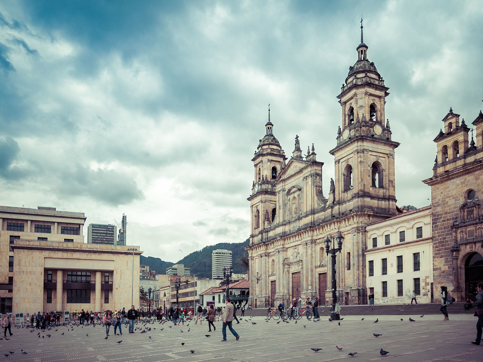
Bogotá (/ˌboʊɡəˈtɑː/,[13][14] also UK: /ˌbɒɡ-/, US: /ˈboʊɡətɑː/,[15] Spanish pronunciation: [boɣoˈta] (listen)), officially Bogotá, Distrito Capital, abbreviated Bogotá, D.C., and formerly known as Santa Fe de Bogotá (Spanish: [ˌsanta ˈfe ðe βoɣoˈta]; lit. 'Holy Faith of Bogotá') during the Spanish Colonial period and between 1991 and 2000, is the capital city of Colombia, and one of the largest cities in the world. The city is administered as the Capital District, as well as the capital of, though not part of, the surrounding department of Cundinamarca.[16] Bogotá is a territorial entity of the first order, with the same administrative status as the departments of Colombia. It is the political, economic, administrative, and industrial center of the country.

Bogotá was founded as the capital of the New Kingdom of Granada on 6 August 1538 by Spanish conquistador Gonzalo Jiménez de Quesada after a harsh expedition into the Andes conquering the Muisca, the indigenous inhabitants of the Altiplano. Santafé (its name after 1540) became the seat of the government of the Spanish Royal Audiencia of the New Kingdom of Granada (created in 1550), and then after 1717 it was the capital of the Viceroyalty of New Granada. After the Battle of Boyacá on 7 August 1819, Bogotá became the capital of the independent nation of Gran Colombia. It was Simón Bolívar who rebaptized the city with the name of Bogotá, as a way of honoring the Muisca people and as an emancipation act towards the Spanish crown.[17] Hence, since the Viceroyalty of New Granada's independence from the Spanish Empire and during the formation of present-day Colombia, Bogotá has remained the capital of this territory.

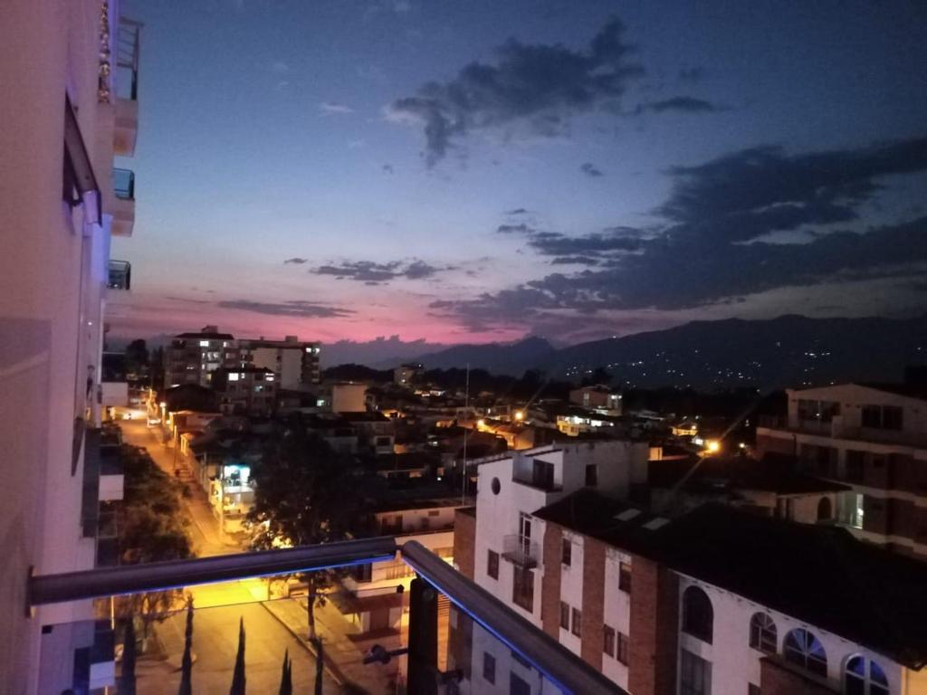
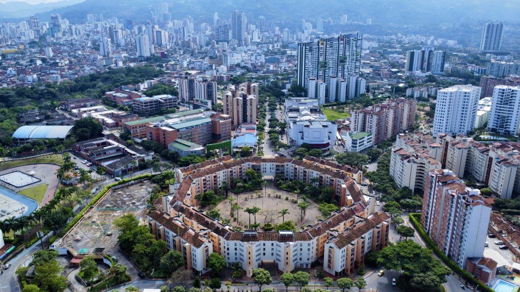
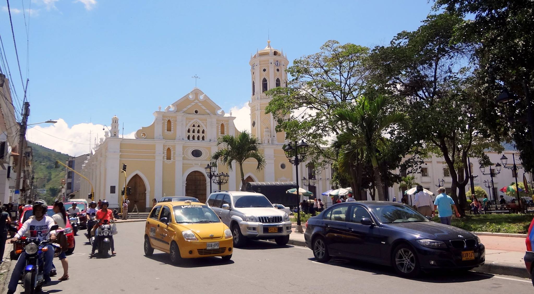
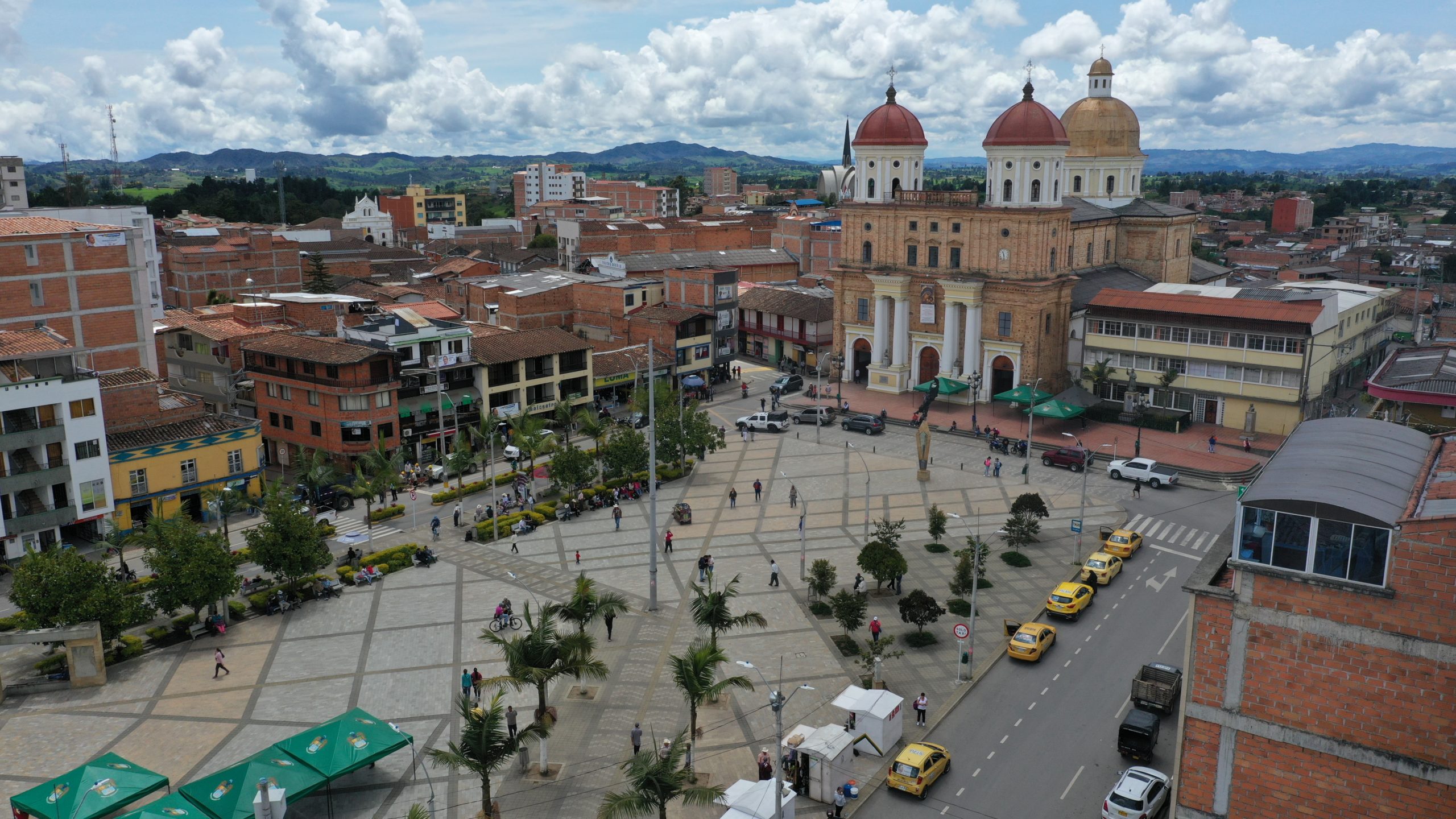
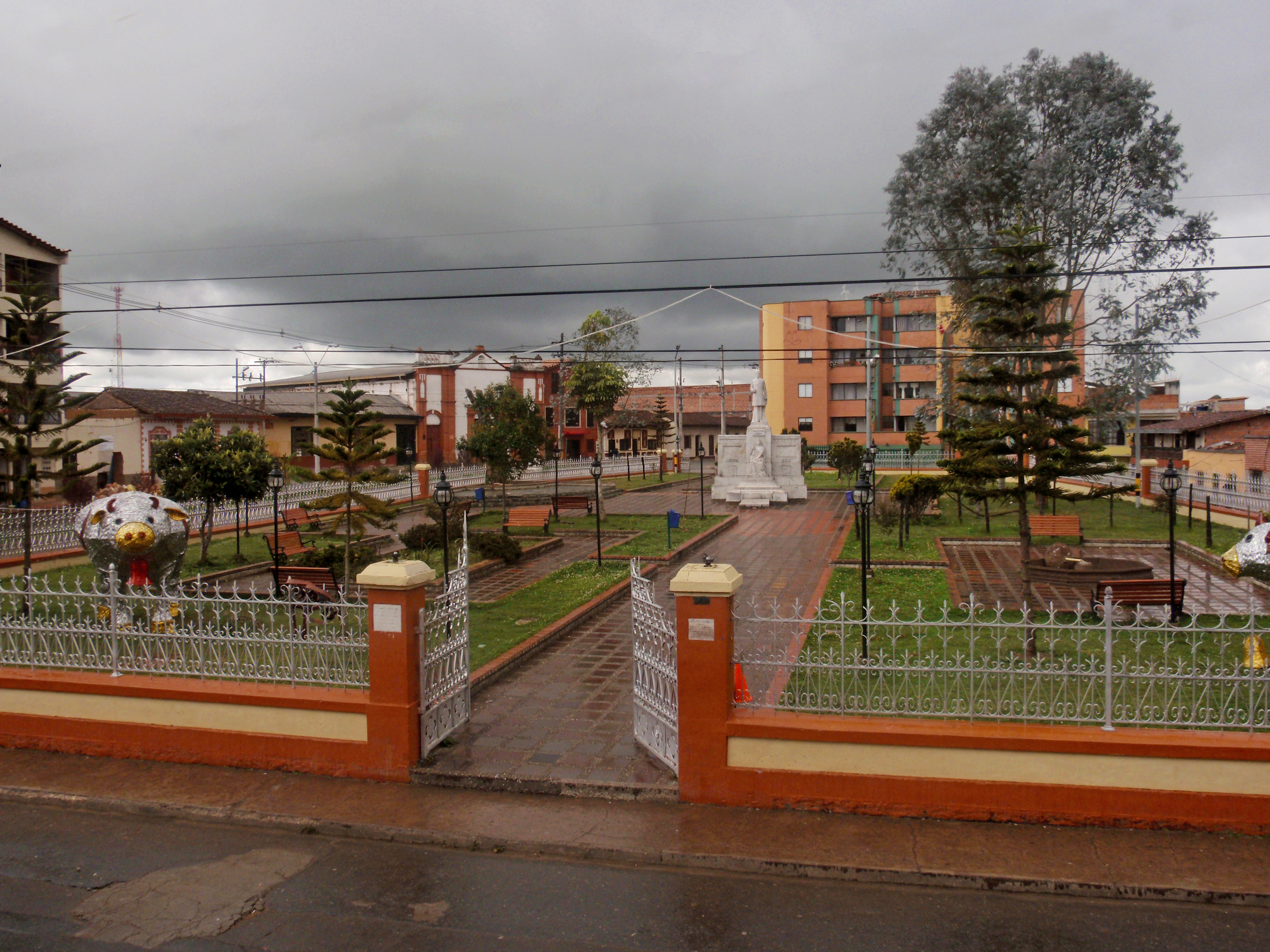
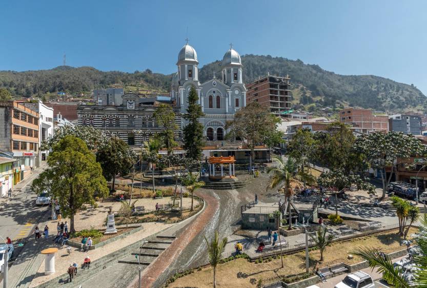
The city is located in the center of Colombia, on a high plateau known as the Bogotá savanna, part of the Altiplano Cundiboyacense located in the Eastern Cordillera of the Andes. Bogotá is the third-highest capital in South America and in the world after Quito and La Paz, at an average of 2,640 meters (8,660 ft) above sea level. Subdivided into 20 localities, Bogotá has an area of 1,587 square kilometers (613 square miles) and a relatively cool climate that is constant through the year.

The city is home to central offices of the executive branch (Office of the President), the legislative branch (Congress of Colombia) and the judicial branch (Supreme Court of Justice, Constitutional Court, Council of State and the Superior Council of Judicature) of the Colombian government. Bogotá stands out for its economic strength and associated financial maturity, its attractiveness to global companies and the quality of human capital. It is the financial and commercial heart of Colombia, with the most business activity of any city in the country.[18][19] The capital hosts the main financial market in Colombia and the Andean natural region, and is the leading destination for new foreign direct investment projects coming into Latin America and Colombia.[20] It has the highest nominal GDP in the country, responsible for almost a quarter of the nation's total (24.7%).

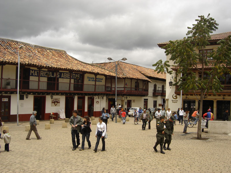
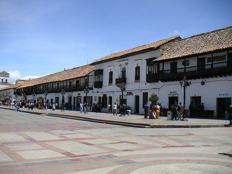
The city's airport, El Dorado International Airport, named after the mythical El Dorado, handles the largest cargo volume in Latin America, and is third in number of passengers.[21] Bogotá is home to the largest number of universities and research centers in the country,[19] and is an important cultural center, with many theaters, libraries and museums. Bogotá ranks 52nd on the Global Cities Index 2014,[22] and is considered a global city type "Beta +" by GaWC.[23]

Image

Image

Image

Image


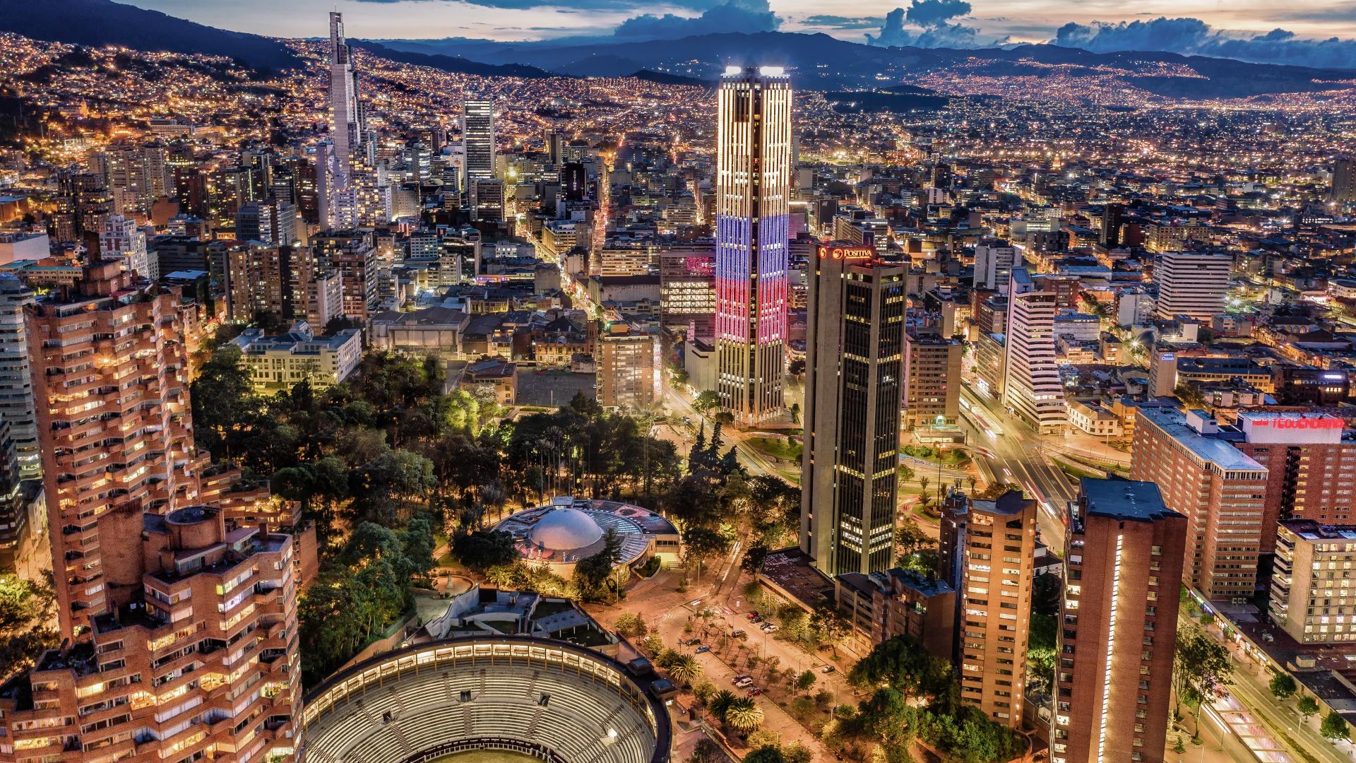
Aerial View of Bogotá by Drone


Bogota Colombia Walking Tour 4k | 🇨🇴 How the Capital of Colombia looks like


Where to Party in Bogota Colombia ? Zona Rosa and Zona T September 2022
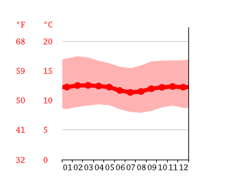
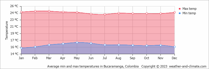


Climate

Image

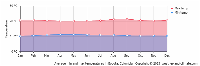
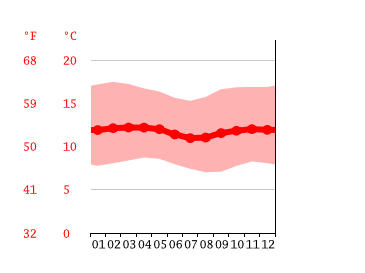
Bogotá has an average high of around 19º (66F) all year round and an average low of around 8º (46F) most of the year, although night temperatures drop somewhat lower in the winter months. Bogotá is significantly colder than other major Colombian cities like Medellín due to its greater altitude, so much so that it is nicknamed La Nevera or "the fridge".
User avatar
Lucas88
Experienced Poster
Posts: 1752
Joined: April 24th, 2022, 1:06 pm

Profiles of Colombian Highland Cities

Post by Lucas88 »

There are also various sizeable highland municipalities located in the department of Cundinamarca which surrounds Bogotá but of which Bogotá isn't officially a part.


Fusagasugá

Department – Cundinamarca

Population – 134,523

Elevation – 1,765m

Image

Fusagasugá (Spanish pronunciation: [fusaɣasuˈɣa]; from Cariban fusagasuga 'woman who becomes invisible') or Fusa is a town and municipality in the department of Cundinamarca, in central Colombia. It is located in the warm valley between the rivers Cuja and Panches, a central region of the Andes Mountains in South America. The municipality has an estimated population of 134,523 as of 2015. The urban region has 108,157 inhabitants.[1][4] The municipality itself covers an area of 206 km2 (80 sq mi).[1][3][5][6][2][7]

It was founded in 1592 by Spanish priests. The town located some 56 kilometers from the capital, Bogotá; borders Pasca, Arbeláez, Tibacuy, Silvania and other municipalities of Sumapaz. Its elevation is 5,669 feet (1,728 m) above sea level, and the average temperature 20 °C (68 °F).

Image

Image

Image


Aerial View of Fusagasugá by Drone


Recorriendo Colombia (Fusagasugá nocturna)


Facatativá

Department – Cundinamarca

Population – 141,762

Elevation – 2,586m

Image

Facatativá is a city and municipality in the Cundinamarca Department, located about 18 miles (31 km) northwest of Bogotá, Colombia and 2,586 meters above sea level. The city is known for its Archaeological Park Piedras del Tunjo (Rocks of the Tunjo Indian) and best known in Colombia as Piedras del Tunjo (literally, Rocks of Tunjo), although locals call it Piedras de Tunja (Rocks of Tunja). It features large rock formations that were once the bottom of a lake.
Image

Image

Image


Aerial View of Facatativá by Drone


Recorriendo Colombia (Facatativá-Cundinamarca)


Climate

Facatativá has an average high of around 19º (66F) and an average low of around 7º (44F) all year round.


Zipaquirá

Department – Cundinamarca

Population – 130,432

Elevation – 2,650m

Image

Zipaquirá (Spanish pronunciation: [sipakiˈɾa]) is a municipality and city of Colombia in the department of Cundinamarca. Its neighboring municipalities are Cogua and Nemocón to the north; Tocancipá to the east; Tabio, Cajicá and Sopó to the south; and Subachoque and Pacho to the west. Its seat of municipal government is 49 kilometers from the national capital Bogotá. It is part of the Greater Bogotá Metropolitan Area, and is the capital of the Sabana Centro province. It is also the headquarters of the diocese of the same name and that includes much of the Department of Cundinamarca, extending to the centre of Bogotá, the region of Rionegro, the Ubaté Valley, and the region of Guavio.

The town is primarily known for its Salt Cathedral, an underground church built inside a salt mine in a tunnel made as result of the excavation of the salinas. Zipaquirá has an original architecture, and the old city centre is a tourist attraction. Its main square is surrounded by old buildings in the Spanish Colonial style. This small city can be reached by train from Bogotá.

Image

Image

Image


Aerial View of Zipaquirá by Drone


ZIPAQUIRA CITY WALK TOUR COLOMBIA 2021


Climate

Same as Facatativá.
User avatar
Lucas88
Experienced Poster
Posts: 1752
Joined: April 24th, 2022, 1:06 pm

Profiles of Colombian Highland Cities

Post by Lucas88 »

Tunja

Department – Boyacá

Population – 172,548

Elevation – 2,820m

Image

Tunja (Spanish pronunciation: [ˈtuŋha]) is a city on the Eastern Ranges of the Colombian Andes, in the region known as the Altiplano Cundiboyacense, 130 km northeast of Bogotá. In 2018 it had a population of 172,548 inhabitants.[1] It is the capital of Boyacá department and the Central Boyacá Province. Tunja is an important educational centre of well-known universities. In the time before the Spanish conquest of the Muisca, there was an indigenous settlement, called Hunza, seat of the hoa Eucaneme, conquered by the Spanish conquistadors on August 20, 1537. The Spanish city was founded by captain Gonzalo Suárez Rendón on August 6, 1539, exactly one year after the capital Santafé de Bogotá. The city hosts the most remaining Muisca architecture: Hunzahúa Well, Goranchacha Temple and Cojines del Zaque.

Tunja is a tourist destination, especially for religious colonial architecture, with the Casa Fundador Gonzalo Suárez Rendón as oldest remnant.[2] In addition to its religious and historical sites it is host to several internationally known festivals and is a jumping-off point for regional tourist destinations such as Villa de Leyva, Paipa, and Sierra Nevada del Cocuy. It is a stop on the Pan American Highway which connects Tunja to Bogotá and Santa Marta and eventually to the northern and southernmost parts of South America.

Image

Image

Image


Aerial View of Tunja by Drone


TUNJA, COLOMBIA - CAMINANDO POR EL CENTRO DE LA CIUDAD


Climate

Image

Tunja has an average high of around 18º (64F) and an average low of about 8º (46F) all year round.


Sogamoso

Department – Boyacá

Population – 111,336

Elevation – 2,569m

Image

Sogamoso (Spanish pronunciation: [soɣaˈmoso]) is a city in the department of Boyacá of Colombia. It is the capital of the Sugamuxi Province, named after the original Sugamuxi. Sogamoso is nicknamed "City of the Sun", based on the original Muisca tradition of pilgrimage and adoring their Sun god Sué at the Sun Temple. The city is located at an altitude of 2,569 metres (8,428 ft) on the Altiplano Cundiboyacense in the Eastern Ranges of the Colombian Andes.

Image

Image

Image


Aerial View of Sogamoso by Drone


SOGAMOSO BOYACÁ | La Capital del Sol y del Acero


Climate

Image

Sogamoso has an average high of around 20º (68F) and an average low of around 9º (48F) all year round.
User avatar
Lucas88
Experienced Poster
Posts: 1752
Joined: April 24th, 2022, 1:06 pm

Profiles of Colombian Highland Cities

Post by Lucas88 »

Bucaramanga

Department – Santander

Population – 681,130

Elevation – 959m

Image

Bucaramanga (Spanish pronunciation: [bukaɾaˈmaŋɡa]) is the capital and largest city of the department of Santander, Colombia. Bucaramanga has the fifth-largest economy by GDP in Colombia, has the lowest unemployment rate and has the ninth-largest population in the country, with 681,130 people. Bucaramanga has over 160 parks scattered throughout the city and has been given the nickname "La Ciudad de Los Parques" ("The City of Parks") and "La Ciudad Bonita de Colombia" ("Colombia's Beautiful City").

Bucaramanga has grown rapidly since the 1960s, mostly into neighbouring locations within the metropolitan area. Floridablanca, Girón and Piedecuesta are inextricably linked geographically and commercially with Bucaramanga, and now all form together the Bucaramanga Metropolitan Area with 1,141,671 inhabitants.[1]

The city is the base of the Colombian Petroleum Institute (ICP),[2] the research branch of the state oil company Ecopetrol.

Image

Image

Image

Image


Aerial View of Bucaramanga by Drone


CAMINHANDO EM BUCARAMANGA - SANTANDER / COLÔMBIA 4K


[ WALKING TOUR ] - Bucaramanga, Colombia - Parque C. Virviescas, Parque de los Sarrapios


Climate

Image

Bucaramanga has an average high of around 25º (77F) and an average low of around 18º (64) all year round.


Piedecuesta

Department – Santander

Population – 163,362

Elevation – 1,005m

Image

Piedecuesta (Spanish pronunciation: [pjeðeˈkwesta], officially Villa de San Carlos del Pie de la Cuesta) is a town and municipality in the Santander Department in northeastern Colombia, South America. It has a population of about 120,000. It is part of the metropolitan zone of Bucaramanga, which is the fifth largest urban area of Colombia by population.

Image

Image

Image


Aerial View of Piedecuesta by Drone


Piedecuesta, Colombia 🇨🇴 | Travel Vlog (Part 1)


Climate

Piedecuesta has an average high of around 27º (80F) and an average low of around 20º (68F) all year round.
User avatar
Lucas88
Experienced Poster
Posts: 1752
Joined: April 24th, 2022, 1:06 pm

Profiles of Colombian highland cities

Post by Lucas88 »

Ocaña

Department – Norte de Santander

Population – 101,158

Elevation – 1,202m

Image


Ocaña looks like a very charming smaller city in the northeastern part of the Colombian highlands and close to the Venezuelan border. It is quite out of the way from the regular expat and tourist destinations and therefore might be a good location for somebody who wishes to live in a more unknown and obscure part of the country. However, in recent years the city has been greatly affected by the Venezuelan Migrant Crisis. It might be less safe as a result of this.

The following is translated from the Spanish-language Wikipedia:
Ocaña is a Colombian municipality located in the department of Norte de Santander, in the northeast of the country. It is found in the western subregion, known colloquially as the Province of Ocaña. The municipality has an area of 672,27 km² and an average elevation of 1202 meters above sea level. It is located in the west of the department, upon the eastern mountain range and is crossed by two rivers: the Algodonal (the name which the river Catatumbo receives in the municipality) and the Tejo, as well as various ravines.

It is known in Colombian history for the Convention of Ocaña and also for its gastronomy and the Virgin of Torcoroma.

With more than 111,000 residents in 2018, it is the second most populated city in Norte de Santander. It is one of the Colombian municipalities that have received the constant influx of Venezuelan migrants during the Venezuelan Refugee Crisis, which means that the previous figure could actually be higher.

Image

Image

Image

Image


Aerial View of Ocaña by Drone


Esta es Ocaña


Travesía: Turismo por Ocaña


Climate

Ocaña has an average high of around 25º (77F) and an average low of around 18º (64F) all year round.
User avatar
Lucas88
Experienced Poster
Posts: 1752
Joined: April 24th, 2022, 1:06 pm

Re: Profiles of Colombian Highland Cities

Post by Lucas88 »

Here are some towns in the northern subregion of Antioquía not too far from the department capital of Medellín. These too might be good options for those who prefer living in a quiet town a bit out of the way.

Santa Rosa de Osos

Department – Antioquía

Population – 37,864

Elevation – 2,550m

Image

Santa Rosa de Osos is a middle city and municipality of Colombia located in the northern of the department of Antioquia. Bounded on the north with the municipalities of Yarumal and Angostura, on the east with Guadalupe and Carolina del Principe, on the south with the municipalities of Donmatías, San Pedro de los Milagros and Entrerríos, and on the west with Belmira and San José de la Montaña.

Image

Image

Image

Image


Aerial View of Santa Rosa de Osos by Drone


SANTA ROSA DE OSOS El Municipio más ALTO y FRÍO de Antioquia COLOMBIA


Santa Rosa de Osos ANTIOQUIA walking tour CAMINANDO


Climate

Santa Rosa de Osos has an average high of around 18º (64F) and an average low of around 7º (44F) all year round due to its greater altitude. Indeed, the name of the second video included above translates to "Santa Rosa de Osos - The highest and coldest municipality of Antioquía, Colombia". Probably a good place for those who enjoy cooler climates.


Yarumal

Department – Antioquía

Population – 41 542

Elevation – 2353m

Image

Yarumal is a municipality in the Antioquia Department, Colombia.

The municipality (three parishes and 20 villages) has an area of 724 km2 (280 sq mi), 35,315 inhabitants, and its average elevation is 2,265 m (7,431 ft) above sea level.

It has a minor basilica, Our Lady of Mercy, which is a parish church of architectural note.

It gave its name to the Yarumal Society for the Foreign Missions (M.X.Y./I.M.E.Y.), a Medellin-based Latin Catholic Society of Apostolic Life of Pontifical Right for Men, which despite its name is especially active in Colombian missions.

Image

Image

Image


Aerial View of Yarumal by Drone


YARUMAL ANTIOQUIA | Tiene las AREPAS más grandes de COLOMBIA


Llegada a Yarumal | Pueblos de Colombia


Climate

Yarumal has an average high of around 18º (64F) and an average low of around 8º (46F) all year round. Not much difference between this town and Santa Rosa de Osos.
Post Reply
  • Similar Topics
    Replies
    Views
    Last post

Return to “Latin America, Mexico, Central America”